Wednesday, August 10, 2016

EVER ONWARD

Image result for dr. seuss travel quotes


July 25:  Up bright and early for our date at the RV hospital in High River, Alberta, just south of Calgary.  I handed the tech our 42 page list of the issues that we would like addressed.  He said, “Will you be leaving your vehicle with us for a month?”.  “No. One day”, I replied.  “Ah”, said he, with genuine Canadian kindness, “We will do our best, eh.”  The dealership was wonderful.  Very knowledgeable, pleasant and accommodating.  They gave us a free loaner car, but we spent the morning employing their wifi to pay bills and post the blog on the net.  Then we went and played golf at a nearby course.  We were delighted when advised, later in the day, that they would like to keep Albie overnight, so they could do more work on her.  Astutely, we found a brand-new Marriott suite in which to spend the night, watch the Monday speeches at the Democratic National Convention and totally chill out.

July 26:  Albie was ready to go by 11:00 AM, so we returned to the dealer, where they carefully explained all the work they did, what they could not do due to need for parts and what we should do to connect with the national Roadtrek factory in Kitchener, Ontario on our trip east to fix the remaining issues.  They also gently tried to persuade us to trade in our vehicle for a brand-spanking new one, taking advantage of the 30% discount because of currency difference between Canada and the US dollars.  We politely declined, but the new ones were magnificent.  
OLD GRAIN ELEVATORS, NANTON, ALBERTA
AMERICAN AVOCET
AMERICAN AVOCET
We drove south through the broad Albertan high prairie, at about 4000 feet elevation, steadily aiming at the good old USA.  All the while, the sawtooth horizon of the Rockies cut through to our west.  A slight detour at the small town of Nanton for groceries slowed us down enough to take close looks at some of the prairie potholes with ducks and their broods.  So, ever distrustful of completely straight lines, which tend to prevail on the flatland, we made a two hour rectangular detour searching for wet spots that might hold southbound birds that had completed their odyssey to the far north, as had we.  Eventually, we came to the very small town of Nobleton, Alberta, which had, much to our pleasure,  eschewing modern technology, a series of mid-sized sewage lagoons consisting mostly of shallow stinking water and mudflats.  Well, ladies and gentlemen, this is heaven for birds and birders, and 
after poking around for a bit, we hit the motherlode.  One pond was chock full of migrating Franklin’s gulls, black-necked stilts, American avocets, Hudsonian godwits, long-billed curlew, greater and lesser yellowlegs, numerous Wilson’s phalaropes, willets (western form), so we set up the scope and were having a blast, until we got blasted by one of those gigantic prairie storms that rolled in on us.  Torrential rain accompanied by marble-sized hail, pounded our roof, creating a racket that made conversation impossible.  So we had lunch!  The storm passed fairly quickly and we went back to birding for a bit before continuing our journey south.  When we crossed into the US, at a lightly used border station, the obviously bored guard confiscated our just-purchased tomatoes and peppers because they contained seeds.  I hope they made a nice dinner.
HAIL STORM, NOBLETON, ALBERTA
SWAINSON'S HAWK, MONTANA
Onward to Babb, Montana, where the campground at which we intended to stay declared itself defunct.  Onward to St. Mary, where hundreds, if not thousands of travelers spend the night before descending on adjacent Glacier National Park, to get an early jump on those precious few campsites.  As did we.  We drove up and over The Highway to the Sun, through 6600’ Logan Pass and down the narrow serpentine ledge that passes for a two-way road to Avalanche Campground, where we actually secured a lovely campsite.  Once settled, not having sufficient knowledge of the now over-population of the park, we drove back up the  tortuous 17 miles to the Logan Pass Visitor Center, where we assumed we could park, get some information and go for a walk.  Not to be.  The parking lot was so jammed with cars there were no places available and lines of vehicles circled like vultures waiting to pounce on a open spot.  After some minutes of this, we gave up, deciding to go for a walk to Jackson Glacier, one of the few remaining glaciers in almost Glacier-less National Park.  We arrived, overcoming massive slow traffic along the route, to find so many vehicles and walkers there that the entire experience was completely unappealing.  We turned around and drove an hour back to our campsite for lunch and a nap.  We have learned a VERY important lesson and would like pass that along to all you prospective travelers to the big national parks of the US and Canada.  DON’T EVER COME DURING JULY AND AUGUST!!!!!!  While the parks are still beautiful, magnificent and worthy of every superlative adjective you can imagine, the crowds dilute the experience to make it more frustrating than enjoyable.  If you have no other choice but to venture forth in those heavily visited summer months, do your research in advance, pick your spots and get to them very early in the day for the greatest enjoyment of a natural experience.  We did this at Emerald Lake in Alberta’s Yoho National Park and it is a strategy we will adhere to rigidly forevermore.
HAYSTACK CREEK, GLACIER NP
Now, relaxing at our site, with the piercing songs of varied thrushes ringing in our ears, we’re gearing up for a hike somewhere nearby, where we and I’m sure several thousand others will enjoy nature at its finest.  
Well, we never made it on our walk, since thunder and a few drops scared us off.  We did wander around the campground and talk to a couple of other owners of RVs similar to ours, comparing notes and checking out their vehicles.  Some creative, talented, hands-on kind of people actually buy a shell and do their own conversion.  This is basically a foreign concept to me.  I’m much better at writing checks.  Other vehicles come fully equipped, like ours, but have different engines, fuel, beds, cooking, storage, etc.  If only there was some way to stay the same size, carry golf clubs, fishing and photo gear AND a small boat it would be perfect.  We’ve got to find an inflatable canoe that takes up no space, self-inflates and has the stability of an aircraft carrier.  Suggestions?  
Since our previous site-occupiers had left us a stack of firewood, we had no choice but torch it and sit outside, even if some of the time was under an umbrella when droplets began to fall.  Still, there’s that cozy feeling from enjoying a campfire, smoke billowing in your face no matter which direction you sit, even if the only thing we had to cook up was ideas.

MOUNTAIN GOAT WITH KID
HIDDEN LAKE
July 28:  Got up early again (egad, what’s happening to us?) to attack the throngs at Glacier with our new strategy.  By 7:30 AM we had arrived at the dread parking lot at Logan Pass, where already masses were gathering for their assaults on every trail and facility the park has to offer.  After eating breakfast in the parking lot, we, along with many others, began our 1.5 mile walk up the hill to Hidden Lake.  Fat ones, lean ones, short ones, tall ones - all marching up the broad boardwalk installed to protect the land from the hordes.  It was a clear, windless day, and with the strong mountain sunshine, we doffed our jackets rather quickly.  At 7000 feet, we made it to the lake overlook, albeit with a wee bit of gasping.  A wedding was being held on an adjacent outcrop, where the entire wedding party, in full bride and groom glory, had marched up the hill with gown and suit underscored by hiking boots.  Just to the right, as we took our places on the overlook platform, a female mountain goat clambered over the ledge, kid in tow, and rolled in a dirt wallow she obviously had used previously.  This was obviously the nine o’clock goat under contract to perform for the crowds.  She was wearing a collar with a device attached to it, aptly dubbed a “goat pro” camera by one of the observers.  A fat hoary marmot sunbathed nearby.  Later, a male goat, also similarly collared as part of a study, crossed the path just in front of us.  Hidden Lake, meanwhile, revealed itself to us in all its glory and was quite beautiful with its deep jade tones and surrounded by still lightly snowy mountains.  We took a little side trail and were rewarded not only with some respite from the crowds, but there were a ton of birds there!  Gale saw a black swift fly by, plus there several kinds of sparrows, red crossbills and a couple of teeny-weeny calliope hummingbirds.  We managed to get back down the hill without incident or injury and then swung Albie into traffic for the long twisting descent to the western exit of the park.  

We stopped at the very cute, artsy-fartsy town of Whitefish, Montana for a stroll among the shops.  We did find one bit of reality - an ice cream store that made its own stuff from local ingredients.  Delicious!  Chocolate ice cream with tiny chocolate chips. Perfection!  Onward toward Eureka, where we will play golf tomorrow.  But where to spend the night?  We adhered to Murphy’s Law and landed on the shores of Murphy Lake, where I fly-fished for underwater sticks for about an hour until I caught my limit.  This was actually a beautiful unofficial campsite, right on the lake shore.  We sat out in folding chairs and watched the slow sunset while we had our usual gourmet dinner.

RED CROSSBILL
July 29:   Camped on a little dirt side road, we went for a pre-breakfast walk.  Almost immediately, we found an adult and juvenile red-naped sapsucker, a lifer for Gale we had hoped to see somewhere in the area.   There was also a small flock of red crossbills roaming through the conifer tops, one of which amazed me during breakfast when it perched right outside the RV window for great shots.  
MURHY LAKE
We headed north to the old mining/logging town of Eureka, Montana and almost to the border of British Columbia to play at The Wilderness Golf Club, a resort truly in the middle of nowhere that apparently subscribed to the notion, “Build it and They Will Come”.  That didn’t work out so well at first and the course went bankrupt, but the current owners seem to be doing much better, selling luxury cabins and timeshares for those who really want to get away from it all.  The course itself was difficult, especially for a first-timer, but a lot of fun and in great shape.  One problem was that when we finished, it was 95 degrees!  The humidity was only 23%, which made the heat bearable to some extent, but we decided to tough it out by sitting in the bar, drinking beer and watching the second round of the PGA tournament.  We brought in our maps and itinerary and figured out that we needed to get up in the mountains tonight to find some cooler air.
That’s when the trouble started.  We had decided to go to the tiny town of Yaak, Montana, about 4000 feet higher than where we were.  As usual, we programmed my phone for the best route and made the error of actually following its directions.  Paved Route 92 gave way to unpaved road, so we gamely continued, winding up and up.  A herd of five deer watched us like we had arrived from outer space before bolting into the forest.  We came to a fork in the road, but unwilling to follow Yogi’s advice, we chose not to take it, since one way - the route our phone said to take, was now very narrow, rutted and had tall grass growing in the middle and the other went up Maria Mountain, which was not that appealing either.  At any moment, we expected a swarm of survivalist paramilitary mountain folks to surround us and take us home for dinner.  Which reminds me of a tee shirt I saw a guy wearing at Glacier NP.  The front read: “The Donner Family Restaurant - Serving Humanity since 1847”.  I must get one.  Anyway, we turned around and successfully descended to pavement, found the right curvy ascending paved road toward Yaak and took it.  By this time, I was pretty beat driving these winding roads and it was getting late, so we only went about 10 miles before finding a perfect little camping area for the night. 
Here’s something that I’ve noticed.  Throughout the trip, especially out here, we’ve seen the usual numerous roadside crosses where people have met an unfortunate fate in vehicular mishaps.  However, I’ve never seen a plastic flower-studded Star of David in any of my travels.  Seems to be a cultural thing, but Jews apparently either do not die in car crashes or don’t put up religious mementos when they they do. I suspect the latter is a more accurate assessment.  Just an observation.  A mountain cottontail welcomed us for the night and that’s all I’m going to say about that.

July 30:  As we went up and over the mountain this morning, a family of ruffed grouse with five chicks placidly strolled across the road just ahead of us.  We were riding six white horses and comin’ round the mountain, which really makes a lot of noise, taking us 35 miles through the forest and eventually to Yaak.  Since this is that kind of place, we did not talk back, driving past the Dirty Shame Saloon, just across the street from the Yaak Tavern, which seemed to be the only surviving businesses in town.  Forced by obviously misplaced mountains to take a somewhat circuitous path to our ultimate destination somewhere near the Coeur d’Alene River, we wound our way north, south, east and west before finally crossing the Continental Divide at Thompson Pass and into the great state of Idaho, where tubers (not the potato sort), were floating down a broad, shallow, crystal clear expanse known as the above river.  We did see some scantily clad people making the float who did closely resembled Idaho potatoes, completely baked.  All they lacked was the butter, sour cream and chives.  
RUFFED GROUSE
Finally, after winding for 20 miles north along the river, we arrived at our place of destiny, where no less than the Yellow Dog Creek flowed into the Coeur d’Alene.  We did see a yellow dog floating on someone’s raft, but again, I digress.  Here there was supposed to be a trail leading up the aforementioned YDC to Shadow Waterfall, where BLACK SWIFTS were nesting behind its watery curtain.  Alas, the unmarked, unmaintained trail was narrow, overgrown and very uncertain as to length or disposition.  Plus it is berry season, when our ursine friends like to flop in the fruit patch and stuff themselves.  Until some unsuspecting tourist comes along to provide a bit of protein with the meal.  Reluctantly, we agreed that our search for the grail must come to a premature end and retreated to Albie for consolation.  We did manage to secure the last site at a National Forest campground along the way out, where, although it is still almost 90 degrees, we have shade and a picnic table.  All for the senior Golden Pass holder price of $9.00.  What a deal!  We didn’t have the right , so we slipped a tenner into the envelope, figuring it was all for a good cause, but about an hour later the campground host came by with a dollar for us.  So nice when those sort of things happen.  We took a little walk around the campground, dropping down to the Coeur d”Alene River for a view, where a couple of people had parked their lawn chairs in about a foot of quickly moving cool water and were enjoying the refreshing current.  We returned to the campsite and were sitting outside, delighting in the wind through the trees, I writing and Gale reading.  BUT, if I had to take a course in sitting still for very long, I would definitely get an “F”.  The wonderful Yiddish word for this affliction is shpilkas, or vaguely translated, “ants in your pants”.  So after dutifully composing the above, I put on my swim trunks, returned to the cool flowing embrace of the Coeur d’Alene (“coor dahlane”) and plunged in.  There definitely was some shrinkage involved while submerging in these chilly waters, but in moments, the temperature could not have felt better.  The only problem was that I was wearing foam rubber sandals, which, while they protected my feet from the slippery stones, were made from extremely floaty material, so when I sat down on the stream bottom, my feet instantly jumped up to the top, sending me ass over teakettle backward into the flow.  In 18 inches of water, it was great!  As things often happen, I began having a nice conversation with the two folks in the lawn chairs.  They were from the city of Coeur d’Alene, Idaho, about 50 miles away, and both worked at a company that works primarily with forestry (lumbering) companies that replant up to 85 million trees each year that have been harvested for timber.  To accomplish this amazing statistic, they bring in people mainly from Mexico and Guatemala on work visas, to hand plant the sprigs that will ultimately become trees.  This is extremely hard work and although it pays between $14-20/hour, they said they can’t get very many Americans, of any ethnicity, to do the back-breaking labor.  And, according to them, when they do find an American, they usually quit within hours because the work is so hard.  Draw your own conclusions, my friends.  Anyway, I come back from my swim, cooled off, refreshed, but can’t get that beautiful clear water out of my mind.  So I return with my fly rod for half an hour, practicing casting.
One word about the people of the northwest.  They really know how to enjoy the outdoors, even in places where there is no phone service!  It seems like everyone camps in a tent or RV of every conceivable sort when the weather is conducive or when it is not.  
My new friends, who are camped right across the road from us, invited us over for a beer after dinner, so, being sociable folks, we visit.  We had a blast!  Another couple was there, the sister and brother-in-law of our hostess and during four glasses of wine for me and couple of brews for Gale, we were really enjoying ourselves.  Now, I must say, my usual limit is one cup of wine, since I have an inordinately low tolerance for alcoholic beverages, so I was pretty wasted by the time we left, very glad we were only 50 feet from home.  With Gale’s assistance, I made it, although the forest was now whirling around me, and with that, I wish you all a pleasant good night.

FLOATING GREEN, COEUR D'ALENE GOLF COURSE
July 31:  When traveling in an RV, your perspective on what makes a day great can vary widely from similar expectations of the general populace.  We found a gas station that had BOTH fresh water for our tank and a dump station for our other tanks.  Heavenly!  After that, the day only got better.  We continued on into the City of Coeur d’Alene and played golf at the posh resort of the same name.  This course is famous for one thing: the 14th hole is a par 3 with a floating green!  That’s right - the green is about one acre in size, beautifully decorated with flowers, has sand bunkers and is towed around into a new position every day and anchored into place.  A beautiful old Chris Craft motorboat takes you and your putter out and back for your time on exquisitely beautiful Coeur d’Alene Lake.  The surface is beautiful, but not the bottom.  In the past, this unfortunate body of water was the dumping ground of a multitude of mining companies that deposited so much toxic sludge into the lake that it can never be cleaned up.  Basically, a really good-looking corpse.  The golf course itself was a delightful resort-type layout, not too difficult, perfectly manicured, but all the holes very interesting.  Like Augusta National, there is no real rough, just a bit of water (remember that floating green) and for the first time in I don’t remember when, I played 18 holes with the same ball.  
Return to reality and back to the same-ole night at Walmart for shopping and a paved campsite under not the stars, but the light posts.

August 1: Despite the fact that we did not see any antelope playing, there was not a cloud in the sky all day.  Air quality is another issue, though.  Throughout the trip, I have been surprised that wherever we go, the air is not as clear as I would have expected or have previously experienced, even in the most remote areas of Alaska and northern Canada.  There is always a haze in the sky.  I don’t know if this is a summer phenomenon or just the new normal, but it has been somewhat disappointing and concerning.  This evening, as we drove south through Idaho, the sky took on a gray/brown cast with the smell of smoke.  There is a major fire somewhere west of us sending smoke this way.  I know there are some huge uncontrolled fires raging in California, but there could be another on this side of the Rockies that is causing this condition.
I played golf again this afternoon, Gale wisely choosing to sit this one out.  About 40 miles south of Coeur d’Alene in Worley, Idaho is the Circling Raven Golf Course, part of the Coeur d’Alene tribe’s casino and resort complex.  The course is absolutely gorgeous, winding up and down and around hills blanketed with golden wheat about to be harvested, dotted with ponderosa pines and lined by tall fescue grasses.  No buildings at all on or near the course, which for me doubles the visual enjoyment of a golf course.  Almost half the holes have forced carries over brush and those tall grasses, making it extremely difficult and unfriendly to most women and short hitters, so Gale made a good choice to just ride around with me as caddie du jour.  We had two most pleasant playing companions from Sand Point, Idaho, who were both very good golfers and knew the course, making for a fun afternoon.  My play was the usual good, bad and ugly, but it’s always a great experience in a beautiful setting.  

THE PALOUSE
From there we continued south on Route 95, traveling through the Palouse, a vast area of largely treeless rolling hills, mainly in grain production, that encompasses much of the Idaho panhandle, eastern Washington and a bit of Oregon.   As we approached Lewiston, Idaho, the road plunged two thousand feet down through the hills to the Snake River and the city of Lewiston, right on the Washington State border.  The air had gotten foul with smoke by now and smelled like there was a campfire right next to us.  We hung a left to begin our first major push east and pulled over for the night in a large rest area next to the Snake River.  Despite the late hour, I whipped up a big omelet with mushrooms, red pepper and onions for our evening meal.  Very tasty!

Monday, July 25, 2016

Alberta, Alberta


"Alberta"

Alberta, Alberta,
Where you been so long?
Alberta, Alberta,
Where you been so long?
Ain't had no loving
Since you've been gone.

July 18:  Went for a walk around the mostly empty, but very nice campground in Grand Cache.  What used to seem so north now seems so south!  White-throated sparrows, whistling O Canada, Canada, Canada are the only birds singing.  In the USA, they sing, Old Sam Peabody, Peabody, Peabody, but when in Rome...  A red-breasted nuthatch sneezes out its nasal yank, yank call, but otherwise, the woods are silent.  We head south to Jasper National Park and the Canadian Rockies.
OVERFLOW CAMPING AT JASPER NP
JASPER NP
Jasper is, as pretty much expected, a zoo, crowded with tourists from all over the world.  We never made camping reservations because we didn’t know when we would get here, so guess what?  Everything is full.  They do have a free overflow camping area, fortunately, so we are parked in a big field, but nobody else is near us.  We are surrounded by staggeringly beautiful mountains and the Snaring River, so there is nothing wrong with this picture.  We’ve got everything else we need in house, so no worries, mates!  When in the bustling little town of Jasper, we did visit the Information Center and manage to make reservations for tomorrow night at one of the regular campgrounds (Wabasso) and for two nights in Banff National Park, further south along the Icefields Highway.

MERLIN
July 19: After a quiet night, we got off to our usual unhurried start.  Unless forced to, we’re just not morning people.  Or night people.  We’re just slow and lazy, I guess.   First stop was the luxurious Fairmont Jasper Park Lodge, nestled on the shores of crystal clear Lake , where we sipped coffee and root beer.  We were now ready for the day’s adventure - a tram ride to the summit of Whistler Mountain, so named for the whistling marmots that make this rocky mount their home.  The skies at the base were sunny and clear, balmy temps prevailing.  It didn’t look so enticing at the top, where black clouds were sweeping across the peaks.  Crammed into the gondola like sardines, we steeply ascended up and up, gaining 3000 feet in elevation.  Emerging from our protective shell, we were pained to find the weather was somewhat less than ideal.  Forty degrees, windy and as soon as we stepped out on the trail, raining.  But then it got better.  A quarter of a mile further on, the rain turn to wind-blown hail, followed by more rain.  All the while, the views of the sun-soaked valley below, emerald lakes gleaming, golf course winding peacefully through the hills, milky blue Athabaska River streaming through, offered no consolation.  My camera was dripping, our binoculars were drenched.  Soaked, we gave up and returned to the summit cafe’ for a steaming hot cup of chocolate, which can cure almost anything.  We returned to the base, where the sun was still shining and happiness prevailed on this little spot of earth.
HAIL STORM ATOP JASPER MOUNTAIN
WHISTLER MOUNTAIN TRAM
Returning to the terminally cute town of Jasper, dripping with boutiques and quaint restaurants in alpine themes, we found a grocery store and fuel to continue our journey, then on to our campground at Wabasso, about 10 miles south of town.    The campground is beautiful, with widely spaced sites set amongst the pines, picnic tables, free firewood (I made a fire - no injuries), a grizzly that wanders around and a pair of noisy merlins that are nesting somewhere close by.  
Before I forget, here’s some totals for the trip thus far:
Bird species seen: 443
Mammal species seen: 53
Road kill species (for 3 of which I am responsible, I’m sad to say): 31

BANFF SPRINGS GOLF COURSE, 1ST HOLE
July 20-21:  These were days of golf, pure and simple, great and wonderful.  In the 1920s, eminent Canadian golf architect Stanley Thompson was commissioned to build two golf courses in the Canadian Rockies.  In 1925, The Golf Course at Jasper Lodge opened and in 1928,  the course at Banff Springs made its debut.  Both courses took advantage of their mountain valley settings and are magnificent testaments to creating a playground that fits with the land instead of overwhelming it.  Each course is ringed by mountains, so towering and majestic that it is difficult and unwise to pay too much attention to what you are doing on the ground.  The golf courses are among the best in the world, but the scenery is the real star and rightfully steals the show.  Perhaps only the fourth hole at Banff, a steeply dropping par 3 called the “Devil’s Cauldron” was so perfect on its own that it has been named the best par 3 hole in Canada, some say in the world.
ATHABASCA RIVER, BANFF
After playing Jasper, we spent the remainder of the day leisurely driving south along the spectacular Ice Fields Parkway to Banff.  We stopped once at the Athabasca Glacier, to see what remains of this once amazing river of ice.  A huge “Ice Center” has been built, including hotel, restaurant, theater, numerous vendors and very little information about the park or the glacier that is not for sale.  Unfortunately, the Center greatly over-commercializes the natural spectacle.  Visitors can still take a bus ride and walk on the flat portion of the glacier, but you have to go a lot further to get there than when I did this with my small children in 1984.  All along the drive there were beautiful blue rivers and lakes plus jade green ponds, all crystal clear.  The water color is due to a combination of light refraction and mineral and glacial silt content.  I love looking at a rushing river and imagining the trout that are hiding in every pool, but I just can’t get my mind wrapped around the water color.  Are the fish electric blue and green as well?  Too weird.
In Banff, we camped at Tunnel Mountain Village 1, a huge, but very nice campground.  Sort of like Banff in the pines, with hot showers!  
Before playing the Banff course, we gave ourselves a quick tour of the Banff Springs Hotel, which resembles a massive castle set amongst the mountains.  It is one of the elegant old hotels built by the Canadian National Railroad from the 1890s to the 1920s to attract the wealthy to ride the rails, so they could stay in opulence in grand settings.  Now owned and operated by Fairmont Hotels, the theme is still pretty much the same, right down to the Elizabethan harpist playing in the lobby and the outdoor terrace dining overlooking the mountains, looking like an apres ski scene from a Hitchcock movie.  You could simply imagine Cary Grant and Grace Kelly dining elegantly on the terrace, sipping martinis and trading mysterious non sequiturs.  
TERRACE DINING, BANFF SPRINGS HOTEL
From the course, we drove into town, which is no easy task even in a small RV.  The streets are narrow and very congested with traffic and people like us wandering around.  Amazingly, we managed to park Albie on a side street, since all of the parking lots clearly state, “No RVs”.  Walking around town is a fun experience, with all the tourists, tourist oriented shops and restaurants.  Like Jasper, but on a 10X scale, this town was built for tourism and nothing else.  We found an exceptional Indian restaurant for dinner, Masala, with a very pleasant atmosphere and gracious service.  We knew it was the right place as soon as we walked in, since half the diners were Indian.  Gale was delighted to find that at the table next to ours, a gentleman and his lady were from farm country right near where she grew up.  They traded tales for a while until it was time to get down to some serious munching.  The food was excellent, as I had chicken saag (creamy spinach sauce) and Gale a chicken masala topped by sliced pistachios, accompanied by a sumptuous garlic nan bread.  Finally returning to the campground at 10:00 PM, we wisely took advantage of the late hour to quickly empty Albie’s tanks and refill her with fresh water to avoid the lines in the morning.

July 22: I had goofed, thinking Yoho National Park was at the same latitude as Banff, but it was farther north, so we had to backtrack 50 miles to get there.  Unfortunately, this was a Friday, and when, shortly before noon, we arrived at the Kicking Horse Campground, it was already full.  Total bummer at the time.  So we continued on to the much more primitively equipped Hoodoo Creek Campground and secured a site.  Fortunate that we did, because in about one hour, the place was also full.  I don’t know what you do if you are in the middle of nowhere, the campgrounds are all saturated and there’s not a Walmart parking lot to be found.  Camping in non-designated areas is also prohibited, so as we used to say, you are “screwed, blued and tattooed”, whatever that means.  Nonetheless, we converted lemons to lemonade and went for a delightful walk through the woods on an old ranger road.  Not much going on, but we did see olive-sided flycatcher, many pine siskins and a western wood-pewee.  Then we drove to the tiny town of Field, BC, to look for “can’t miss” elk.  Dipped.  The good news is that we stopped at the Visitor Centre and got some tips for other good birding spots for tomorrow and the following day.  Right now, back at the campsite, it’s chow time and my number is up for cooking.  See ya!

July 23:  We had a fun day, finally spending more time on our feet that on our butts.  We found Beaverbrook Road, a small dirt side road off Trans Canada Highway 1, which is the primary route through this very mountainous region.  From Beaverbrook, we walked a few miles along old logging roads, occasionally seeing a few little birds, but mostly they were just pleasant walks through the forest.  From one overlook we had a magnificent view of massive Wapta Falls on Kicking Horse River, about 3/4 mile away.  Continuing west on TCH 1, the road is literally blasted out of the rocks, since the canyon walls are so steep.  In one spot, the road simply slices through a rock wall 100 feet tall, making a cut that looks like a 500 yard long napkin holder.  The descent is steep to the ski resort town of Golden, BC, so we went to the mountain and visited King Horse Mountain Lodge, hoping to thumb a ride on their gondola to more alpine terrain.  Unfortunately, the peaks were sheathed in cotton and a rainstorm was sliding down the valley.  Wisdom, rarely one of my strong suits, prevailed and we decided not to go aloft, not wishing to repeat our sodden, frozen Jasper experience.  A much better choice was to go back down the hill and have an ice cream cone.  A truly superb choice that comes from the wisdom of the aged.
KICKING HORSE RIVER, YOHO NP, BC
We turned around and headed back through the sluice box of a highway to the trail for Wapta Falls.  About 1.5 miles each way, the path through the forest eventually emerged at an overlook.  Here the Kicking Horse River violently crashes over a broad thirty foot drop, sending its robin’s egg blue water frothing into the swirling pool below, a fine mist rising above like an ethereal scarf.  By the time we returned to Albie’s welcoming doors, we were pretty much done for the day.  This old body just ain’t what it used to be.  On the other hand (there is always an other hand, isn’t there?), it is quite delightful to return to the campground early, have a chat with our neighbor to discover that a) he is a birder of sorts and b) he is a blues guitarist and singer, so we had a lot to talk about, except of course the playing and singing, which I can’t do but love to listen.  That was so much better than talking with last night’s Canadian neighbour about the sorry state of American politics.  Two revealing opinions from him, though: a) Canadians cannot understand what the appeal of Donald Trump is to intelligent Americans, and b) Canadians think Barack Obama is a great President.  Interesting stuff.  I never talk to Americans about politics because it is too volatile a topic, but it is fascinating to hear the perspective of those just across our border.  Perhaps I will broach the subject with my bluesman/birder neighbour from Vancouver Island, BC, tonight and see what another Canadian has to say about our political affairs.  
No new birds, mammals or road kill for days now.  Seems like weeks.

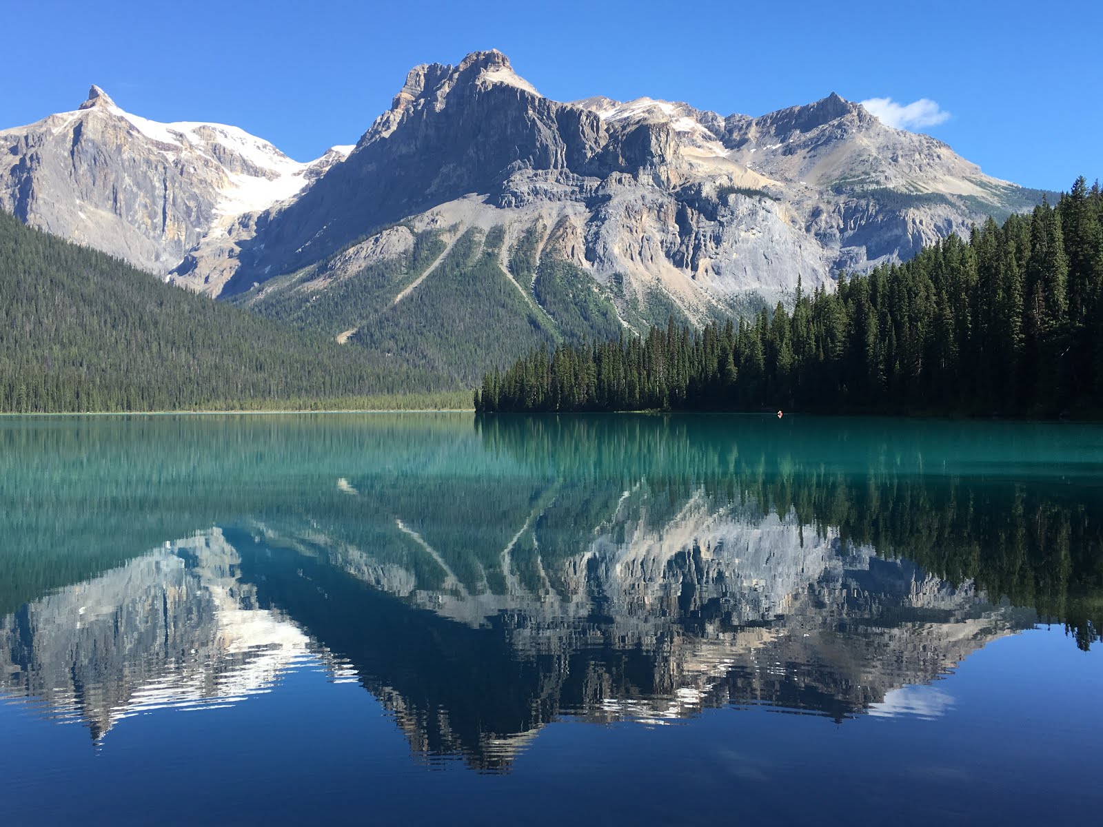
July 24:  A wonderful beginning, but overall a frustrating day.  There have been so many people visiting these magnificent parks that at times it’s like living in an apartment complex in the Bronx, but with postcard scenery that often is so amazing it looks like a Hollywood backdrop.  We decided to try and beat the rush by actually getting up early(!) and going for a hike around Emerald Lake in Yoho NP.  Arriving before 8:00 AM, we actually got the number one parking spot for RVs and the place was so quiet you could hear a boreal chickadee wheeze out its song.  The sun was shining, the sky was blue and the temperature was about 48˚.  Perfection!  Emerald Lake is quite unique.  First of all, you can imagine its singular color.  It lies in a depression carved out by a glacier eons ago and i surrounded by the usual stunning mountain peaks with twisted sedimentary forms in the rock.  One side of the lake is usually sunny and has typical open dry boreal forest habitat.  The other side is highly shaded by the steep mountains and as a result has the look and feel of a temperate rainforest, replete with deep mosses, shady glens, burbling mountain rills and deep dark forest, which is a very rare ecosystem this far north.  To top it off, the north side of the lake, from whence the glacier came and went, is an ancient alluvial fan from the mountains combined with delta sediment from the small Emerald River.  The sediments from both of these sources will ultimately fill in the lake, but in the meantime, they cause the water to be a sparkling jade green.  The walk around the lake is a little over three miles (5.3K - we are in Canada after all). We ambled at our usual strolling pace, taking in as much as we could, reading the very well done interpretive signs that line the path (where else do you think I got all the above information?).  As expected there weren’t many birds around, but we did find two American three-toed woodpeckers side-by-side seriously flaking and digging at a Douglas fir and it appeared that one was an adult showing a young one the tricks of the trade.  There is a very nice lodge here, where we enjoyed a cup of hot tea on the patio after our exertions.  By the time we got back to Albie, the lake was overrun with rental canoes and rowboats, complete with people screaming from them, no doubt in joy, but sound really carries on the water.  There were literally hundreds of folks milling about, snapping selfies with the lake and mountains and the parking lot was overflowing way down the road.  Definitely time to take home the sweet memories and get out of Dodge.  We found a nearby park dump site with fresh water, so we were able to have lunch, clean up and move on down the road.
EMERALD LAKE, YOHO NP, BC
We spent the rest of the day driving south through Banff, Canmore and then on the what we thought was going to be quiet Route 40 circling around Calgary through another section of the mountains.  This road goes through Highwood Pass, which is over 7000’ elevation and we hoped to get out and wander around above the tree line to see what we could find.  Along this “quiet” byway there were so many people out on this beautiful day that stopping anywhere was almost impossible - the parking areas were full and vehicles were parked willy-nilly alongside the highway.  Not quite the wilderness experience we were hoping for.  The pass was overrun with hikers, mountain bikers and too many people like us, so we just kept moving.  The only consolation was seeing two groups of bighorn sheep females and their lambs blocking traffic.  Onward to the little town of Okotoks, Alberta for a date with the laudromat and, believe it or not, a Vietnamese dinner.  Then camping for the night at Walmart.  What could be more American?  Oops, Canadian?

The Cremation of Sam McGee

The Cremation Of Sam Magee 

by Robert Service

There are strange things done in the midnight sun
By the men who moil for gold;
The Arctic trails have their secret tales
That would make your blood run cold;
The Northern Lights have seen queer sights,
But the queerest they ever did see
Was that night on the marge of Lake Lebarge
I cremated Sam McGee.


EDITORIAL

IMPRESSIONS OF ALASKA

After spending 47 days in our 49th state, I more or less got a feel for the place.  It’s not in any way like living there, which is a totally different experience, nor do I have a comprehensive understanding of what drives the state.  To be absolutely clear, I’ve got to say I love Alaska.  I love it for its wildlife, its vastness, its wilderness, its beauty.  But as we were leaving Alaska, driving along a dirt road paralleling the Walker Fork of of 40 Mile River, we saw numerous amateur and semi-professional gold miners panning, digging and generally exploring for gold.  We saw a substantial mining operation re-destroying parts of this previously completely destroyed river and ecosystem, digging up the creek bed, removing the forested “overlay” all around it, tearing down canyon walls either with heavy equipment or high pressure hoses, all to obtain gold.  In fact, I seriously doubt that there is a flowing body of water in most of Alaska that has not suffered a similar fate, first mined by hand, then dredged by giant machines, then blasted to smithereens.  In Nome, Alaska, we watched numerous small boats with bottom sucking equipment going back and forth along the ocean’s edge, ruining the ocean floor, so some gold could be sifted out of the rubble that was then redeposited on the now barren ocean floor.
Now here’s the interesting part.  I’m guessing, and remember, this is not a researched position I am taking, that in no other state in the country would such environmental insults be allowed to occur, and if they did, would be subject to huge fines and criminal penalties, not to mention incurring the wrath of every environmental organization on the planet.  But here in Alaska, not only are these not prosecutable offenses, they are championed activities, fully sanctioned and encouraged by the state!  Freely extrapolating from our Walker Fork experience, it seems to me that the driving force in Alaska, the underlying philosophy and rationale for being for many folks and certainly for the government, is exploitation of natural resources.  This includes gold mining, oil extraction, logging, hunting and fishing and a lot more. I am not condemning these activities.  Hell, we just drove here in a diesel powered vehicle.  I am just saying that in Alaska, there are those who want to overwhelm the environment and extract from it, wring from it, drain its every resource to make money, with not enough thought to preserve the land that is being trampled in the process.  Alaskans complain about too much interference from “the Outside”, especially from the federal government and its gigantic National Wildlife Refuges and the like, but if the feds had not taken action years ago to save the most beautiful, pristine and wild parts of this glorious state, I’m sure the land would have been stripped clear by now, drilled through like Swiss cheese, dug up and ripped apart, all to extract the riches that lay on top of and underneath this fragile arctic soil.  It is a profound and probably never to be resolved battle between the forces that want to destroy the land to get rich and the forces that recognize that they already are rich from their existing natural heritage.  Is there a balance?  Who knows?  No one has asked my opinion.
DREDGE CORN ROWS
FIREWEED ALONG YUKON ROADS

DAWSON CITY FROM "THE DOME WITH CONFLUENCE OF YUKON AND KLONDIKE RIVERS


"


July 11:  So after that tirade about Alaska, you ought to see the Yukon River valley and surrounding river beds.  It’s worse.  Driving east from Dawson City, all you see are giant “corn rows” of river stone, each formed when an immense dredge went along each river, creek, stream, scooping up the ENTIRE river bottom in huge buckets, processing them for bits of gold, then spewing out the river bottom in piles behind it, like some huge river-eating animal shitting out the remains as it plods forward.  East of Dawson, the full valley of the Klondike River, stretching at least 1/2 mile between hills, has been dredged out.  Bonanza Creek, where the original strike of 1897 occurred, is torn to shreds miles and miles back from its confluence with the Klondike.  Where hills come down to meet the river, they have been gutted by high pressure water hoses designed to strip away all loose soil and rock so it can be processed for gold.  
Wrecking the environment for oil, or in the vast iron ore mines in northern Quebec and Labrador which we saw a few years ago, are bad enough, but as a society, we clearly need and have become totally dependent on these commodities.  Wrecking the environment for gold baubles and bangles, on the other hand, is a completely different deal.  I know there is a need for industrial gold as a conductor and also for certain people’s shiny teeth and I’m sure there are other important uses for it, but come on - do we really need to allow and encourage all of this seemingly little regulated destruction?
OK, enough of this.  Let’s get back to what’s fun about this trip.

After doing a bit of banking to exchange $US for Canadian funds, acquiring an ethernet cable for my new bluetooth enabled external hard drive which I cannot figure out how to make work and filling the RV with liquid gold, we finally had to stop clip-clopping our way around on Dawson’s charming wooden sidewalks.  First stop - ascending The Dome - a high round hill that overlooks Dawson, with a five-mile paved road to the top.  Dawson was built on a flat bog along the Yukon River and until 30 years ago, was subject to severe flooding when the river rose, usually due to ice jams.  From atop the Dome, it’s like having a map in front of you - the city directly beneath, the hideous scars from mining to the east, the muddy Yukon running east/west, joining with the clear southbound Klondike and the mountains of Alaska to the west.  You can even see the nine-hole Top O’ The World Golf Course just across the Yukon, perched on a high flat plain.  I played here once, ten years ago, under the midnight sun and had a totally enjoyable experience as black bears and moose freely roamed the course.  The grass greens looked more like shedding caribou than putting surfaces, but that was unimportant in the overall scheme of things.
From here, we continued east 30 miles to the entrance to The Dempster Highway, Canada’s equivalent of the Dalton Highway in Alaska.  The Dempster is a 450 mile ribbon of dirt, stretching from the AlCan Highway almost to the Arctic Ocean.  The difference is that this road crosses two major rivers along its path in the Northwest Territories, the Peel and the mighty Mackenzie (one of the longest rivers in North America, but entirely in the Arctic, so few Americans know anything about it).  To journey from one side to the other of these riparian giants, one must take a ferry.  In winter, the rivers freeze solidly enough that traffic, including large trucks (you’ve heard of “Ice Road Truckers”? - this where they’re from), just rumble across the ice to the other side.  But during mosquito season, the ice melts and the roads are impassable until a) the ice goes out and the ferries are inserted or b) the ice comes back in sufficient strength to support the trucks.  Right now, in warm weather, the river flow goes up and down quite rapidly every day, requiring that earthen ramps get built and rebuilt to allow traffic to board both the cable-driven Peel ferry or the self-powered Mackenzie ferry.  We have learned, much to our dismay, that the water has gotten so high at the Peel River that the ferry cannot operate and is temporarily shut down, thereby severely diminishing our chances of reaching Inuvik at the far end of the Dempster, unless we can teach Albie to either fly or swim in short order.  Neither seems likely, especially since Albie is starting to have more serious mechanical problems, due to the beating she has endured lo these last three months.  Speaking of which, today is the start of our fourth month on the road!
We traveled about 50 miles north on the Dempster and are camped at Tombstone Mountain.  This is the end of the boreal forest, as the road immediately climbs about 1000 feet to the tundra, where we will travel the next 250 miles before reaching the Peel River in the Northwest Territories.  Stay tuned...

July 12:  It was a good day and a bad day.
FOX TAIL BARLEY GRASE
YELLOW WARBLER
DEMPSTER HIGHWAY
We get up bright and earlyish and BEFORE breakfast, take a two-mile hike along the North Fork of the Klondike River.  I had prepped for this trip the night before, learning how to properly use our newly acquired can of bear spray.  To be able to read the instructions on the side of the can, which were too small even for ants to read, I had to turn my binocular around and use it like a magnifying glass.  It’s a good thing you don’t have to do this when suddenly confronted by ursa arctos.  The trail took us through the woods and willows well over our heads, where we could hear the bears licking their chops.  I was ready, though - I had my can of spray on my hip, all set to blast away at the first sign of trouble.  Bear spray is like mosquito repellent, though - despite buying it for a purpose, you’d just as soon not need it.  We didn’t.
THE DEMPSTER HIGHWAY
LYNX TRACK
The trail was pretty quiet, with the pleasant sound of the rushing river always present in the background.  Yellow, Wilson’s and blackpoll warblers flitted about, making only “chip” noises, as did white-crowned and tree sparrows.  A presumptive lynx ran across the path in front of us so quickly all we saw was its rear end, but the large cat tracks in the path proved its provenance.  A pair of merlins were feeding young atop a tall black spruce right next to our campsite!  We visited the new Tombstone Visitor Centre for a bit, gaining some knowledge about the geology and history of the area.  So far, so good.
Then we were off, heading north on the Dempster.  After 20 miles and several stops, we sadly realized that we had completely missed the boat for birding at this time of year.  By mid-July, nothing is singing, and many birds had even already changed directions and aimed south for the winter.  I do most of my bird-finding by listening and then attracting the birds by making unusual sounds that they apparently find offensive, like a bird joke in poor taste.  When nothing is singing and has lost interest in being territorial, birds don’t respond to pishing or squeaking or even playback of their recorded songs. First Result: We can’t see the birds very well and I can’t get any good photos since the birds won’t come close.  
Second Result: we decided to not go any further north on my beloved Dempster Highway, blowing off this portion of the planned trip.  The scenery was gorgeous, but the birds were gone or silent and the large mammals, like moose, bears and caribou, were mostly away from the road.  
Recommendation: come back in early to mid-June at the peak of all wildlife activity, unless all you want to do is see the area.  The Dempster is an absolutely exquisite wildlife and wilderness experience and in my opinion, the best road you can take in North America to see true northern tundra and all that it entails.
We turned around and headed south, back to the road leading toward Whitehorse, YT.  I tried a couple of spots on the tundra for Smith’s longspur, but the tundra was dead quiet.  
HARLAN'S HAWK (RED-TAIL) LIGHT MORPH
Driving in the evening, such as it is, tends to produce the most interesting sightings, so we kept moving until 11:00 PM, ending up in Carmacks, YT for the night.  Along the way, we found two full size young great horned owls and even better, a white morph “Harlan’s” subspecies of the red-tailed hawk.  We had seen quite a few of the dark morphs along the way, but light morph adults make up only 1% of the total population, so this was quite a lucky find!  And at 10:30 PM, no less.  We made one more stop for the evening, overlooking Five Finger Rapids on the Yukon River.  Since it was so late, we were the only people present at this usually popular spot.  In the gloaming, the mighty river slid past the huge rocks in its path, once formidable obstacles to upriver bound paddle wheelers.  Camped on a quiet side road next to the river.

July 13: Got a deliciously late start after being up into the wee hours last night.  Today’s pleasures were totally dominated by the ingestion of insanely good comestibles.  First, we took the side road to Lake Labarge,  stopping for breakfast (at 1:00 PM) at Mom’s Sourdough Bakery.  This place, owned and run by Tracy Harris seemingly forever, is a fixture along the Klondike Highway.  Tracy bakes the best stuff ever and to boot, is a great birder.  She’s slowed down somewhat since a heart attack last year, and now just fires up the oven when she feels like it.  Today she felt like it and we enjoyed a four berry pie that was so tart and tasty my taste buds nearly decided to move there.  Capping it off was a scoop of caramel vanilla ice cream, with little crispy chunks of caramel, hand made by her Swiss neighbor from whole fresh dairy cream.  With a pot of black tea, we could have sat at her gardenside table for even longer, enjoying a sunny day and lots of talk about birds and migration.  What a sweetheart!  We couldn’t leave without taking a giant (9”diameter) cinnamon bun she hadbaked that morning with us, plus a jar of Tracy’s homemade fireweed blossom jelly that tastes like no jelly you’ve ever had before.  Whoever heard of jelly being made from flowers?  Tracy explained that the best way to eat the bun was to slice it in half widthwise, slather the inside with butter and then heat it up in a skillet like a grilled cheese sandwich.  That’s obviously tomorrow’s breakfast.
The next stop was only a quarter mile away, on the marge of Lake Labarge, immortalized in Robert Service’s poem, “The Cremation of Sam McGee”.  I read it aloud to Gale.  Just hearing the words always gives me the shivers and makes me laugh.  Do yourself a favor and google the full poem for your total enjoyment.
Onward to Whitehorse, where we checked into the Westmark Hotel, courtesy of Tourism Yukon.  On their suggestion, we had dinner at Antoinette’s, an upscale Caribbean restaurant just down the street.  Antoinette is from Tobago, loves food and apparently does all the cooking herself.  I had curried chicken, with two potato pancakes, fresh corn, a few spiced shrimp and a length of fry bread all on top.  To say that this was the best meal I have had since we left home, or even in years, would not do this dinner justice.  I can still taste all that juicy, spicy, savory flavor rolling around my mouth.  If you’re ever in Whitehorse....

READING "SAM MCGEE" AT LAKE LABARGE
July 14:  REALLY took our time departing Whitehorse.  First of all, we’re in a nice hotel with cable TV and it was our only chance to see any of the British Open.  We watched Phil Mickelson lip out a putt on 18  that would have given him a 62 and the lowest round ever recorded in a major championship.  We ate eggs benny at the hotel restaurant.  Let’s face it, we dawdled.  We then ran around town, as usual in circles, but finally departed Whitehorse at 12:30 PM.  The rest of the day was driving but had a few  highlights.  
Stopping at the “Sign Forest” in Watson Lake, YT, where a couple of acres is devoted to people nailing up every conceivable type of sign that they have purloined from every conceivable place. Kind of the monumental version of “Kilroy was here.”
SIGN FOREST
WOOD BISON
Our route had largely followed the immense Liard River and I wondered why I had never heard anything about river boat travel up the Liard.  Then we came to the Whirlpool Rapids, where the river split into several raging sections with standing waves, wild water and about an eight foot drop over a ledge.  And that was when the water was low!  A large accumulation of smashed dead trees carried by the river had been deposited at the sharp turn of the whirlpool, at least 30 feet above the present water level!
As we drove southeast from Contact Creek, where the two opposite traveling work forces met building the Alaska Highway in 1942, until about 100 miles on at Liard Hot Springs Provincial Park (where we are camping), wood bison are quite common along the road.  We saw one herd of about 70, plus a family group of a bull, two females and two calves and a few solo huge bulls, sporting furry dark chocolate knickers on their forelegs, huge shaggy heads, a large dewlap and a camel sized hump.  The males apparently like to dig out sandy “wallows” along the road and we encountered one big boy lounging at his private beach, winking at us with fly-covered eyes.  These 2000 pound behemoths like to wander along the highway, and even will sleep on the road at night, making for VERY hazardous driving.  
We didn’t pull in until about 10:30 PM, which is probably why we encountered so many bison, plus a couple of black bears munching on roadside greenery.  Interesting note: the road is very wide along this stretch, with broad shoulders to allow for bison-ogling tourists and space to get around them.  The highway verge is cut back another 100 feet from the road on each side, so that motorists can spot the bison easily and reduce the chance for a collision.  

July 15:  What a joy to be able to write this in the early evening, my butt parked at a campsite picnic table, relaxing with the beverage of my choice, mountain stream gurgling beyond merrily to my right, surrounded by bare rock mountains at Stone Mountain Campground next to Summit Lake, in magnificent northern British Colombia.  We are camped at the northern end of the Rocky Mountains, about 50-100 miles east of Fort Nelson, BC.  Simply put, right now it couldn’t be nicer.  Did I mention that it is 6:30 PM, 75 degrees and the sun is shining?  It actually will get dark here tonight, due to about five hours of no sun and the mountains.  Both of us have gotten somewhat confused in the dark, not really having experienced any of it for about a month and a half.
Today began as pleasantly as it finished, at Liard Hot Springs Provincial Park.  We paid our fee and walked the 1/2 mile boardwalk through the marsh and forest to the natural pools fed by the hot springs.  The pools are edged by forest and have a completely natural setting, with trees, grasses and ferns draping over the water.  The only tipoff of the subterranean thermals is the sulphury smell.  The lower pool was a delightful 100 degrees or so, but as we moved to the higher pool and closer to the spring’s source, the water temp steadily climbed until it was almost scalding!  
LIARD HOT SPRINGS PROVINCIAL PARK, BC
STONE SHEEP
We continued east on the Alaska Highway, slicing across northern BC.  Just before reaching our current campground, we encountered three stone sheep, also known as thin-horn sheep (as opposed to big horn sheep further south), two females and a very perky lamb.  First on the road, they nimbly ran up the side of a rock-strewn cliff like it was a staircase and watched us from their lofty perch.  Choosing our campground was easy - it had great curb appeal - and it’s a pleasure to not be driving late.  Right on the edge of the lake, someone or some people had built a “garden” of small cairns, and right on top of the tallest one sat an adult spotted sandpiper, as if a sentinel.  Which indeed, she was, as some of the rocks on the ground beneath her began to run around  in typical “spottie” fashion, tipping up and down.  She was carefully monitoring her brood of four chicks, so we crept away, not to disturb the family dinner.  Speaking of family dinner, I have been summoned to start cooking.

July 16:  The mountains beckoned this morn, so after a quick breakfast, we started walking up a rough road to a distant microwave relay tower.  After about 2.5 miles of steady climbing, we had passed through tree line and were looking up at a rocky meadow some 500 feet above us.  There was no trail, just tundra and rock scree up a very steep slope.  It looked like it might be rock ptarmigan country up there, so away we went, step by step, wondering what would give out first, the old legs, back or breath.  Slowly zig-zagging our way across the uneven terrain, we made our ascent.  Tiny alpine flowers were everywhere; dwarf birches, no more than one inch tall, were probably 100 years old.  Getting down on my knees for closer inspection (getting up was the problem), I could see wide varieties of multi-colored lichens adorning the ancient fractured rocks.  At the summit, we could now see Summit Lake, where we were camped, now appearing an impossible distance away.  Not so far away, we saw black clouds coming toward us through the mountain passes, accompanied by rumbling thunder and rainfall.  It was time to jet.  We scrambled down the slippery slope with all the agility of sexagenarian mountain goats and headed for home.  No ptarmigan, not many other birds, some caribou tracks and a least chipmunk.  Oh yes, and a lot of pain by the time we got back.  These old bones just aren’t what they used to be.  Back at camp, a small flock of cedar waxwings surprised me - this was an extremely rare sighting for northern BC.
HIKE FROM SUMMIT LIKE TO "NO PTARMIGAN" HILL
We spent the rest of the day driving east to Fort Nelson and then south almost to Fort St. John.  A very large cow moose jumped out of a ditch and ran across the road right in front of us.  Gale’s alert driving saved us from having a moose hood ornament, or the other way around.  It really gets dark now, with about six hours between sunset and sunrise.  We will now take full advantage of that meteorological statistic.
LICHENS
CEDAR WAXWING

July 17:  Major finds of natural gas have completely transformed this area from very rural farming country to booming development for energy.  I have this image in mind when oil is struck - a gusher of black gold.  What image do you get when a successful strike is made for natural gas?  For me, a giant earth fart.  Anyway, there are wells all over the place, with fracturing plants, whatever those are and lots and lots of big truck traffic.  In utter and stark contrast are the immense glowing yellow fields of flowering canola plants.  
We drove and drove through the huge northern Alberta prairie, sometimes in agriculture, sometimes just flat woodland.  Boring.  One thought comes to mind - the farther south we get, the more the land is used by people, altered in character permanently.  Mineral mining, gas extraction, oil drilling, coal mining, farming, more communities, more roads, more people.  Inevitable, yes.  But after where we have been and what we have seen for the last six weeks, it is somewhat disheartening to come back to the reality of too many people, too much use and abuse of the land.  
GRAND CACHE GOLF COURSE
We finally began to see the mountains of the northern Rockies, since we are only about 100 miles from Jasper National Park.  Stopping at the small town of Grand Cache, we learned about the municipal campground and 9-hole golf course just up the hill.  Despite a warning in the pro shop that a grizzly had been hanging around #5,  nine holes and one campsite later, at 8:00 PM we are cooking dinner in the microwave, charging the computer on house current and have the hot water on for showers!  This is luxury!  Add in seven, count ‘em, seven hours of darkness and we are in hog heaven.  Before retiring, we managed to kill off a bag of microwave popcorn, accompanied by reading the poetry of Robert Service.